Old Postcards of Rottingdean
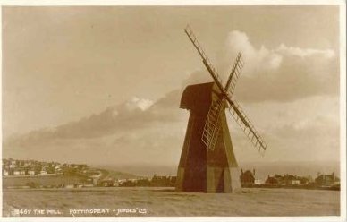 The Windmill. Situated
on Beacon Hill, high above the village of Rottingdean stands the old smock mill.
The mill has been here since 1802 and has been a prominent landmark to sailors
and travellers alike since then. A drawing of this mill by Sir William Nicholson
has since become famous as the colophon used by Heinemann, the publishers.
The Windmill. Situated
on Beacon Hill, high above the village of Rottingdean stands the old smock mill.
The mill has been here since 1802 and has been a prominent landmark to sailors
and travellers alike since then. A drawing of this mill by Sir William Nicholson
has since become famous as the colophon used by Heinemann, the publishers.
The mill continued to grind corn until 1881 and is now preserved by the local Rottingdean
Preservation Society.
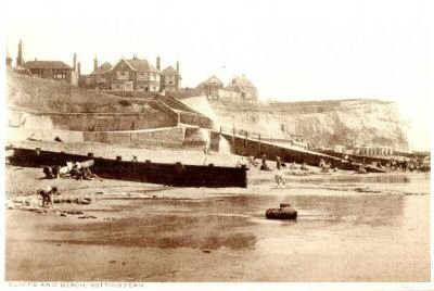
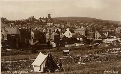
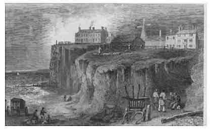 A
village nestling in a downland valley: Dating from 1831 this print
shows the cliffs and beach at Rottingdean before much of this was swept away
by the sea. Notice the windmill on the hill and the Old King of Prussia Inn
that is now known as the White Horse hotel.
A
village nestling in a downland valley: Dating from 1831 this print
shows the cliffs and beach at Rottingdean before much of this was swept away
by the sea. Notice the windmill on the hill and the Old King of Prussia Inn
that is now known as the White Horse hotel.
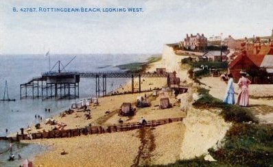
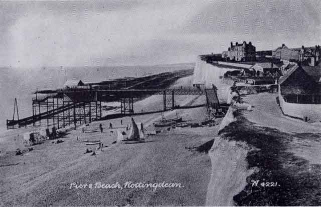
 Ovingdean
Gap -half way between Black Rock and Rottingdean. A pier and landing
stage is in the process of being built for Volk's railway. Note the old barge
in the process of depositing building materials.
Ovingdean
Gap -half way between Black Rock and Rottingdean. A pier and landing
stage is in the process of being built for Volk's railway. Note the old barge
in the process of depositing building materials.
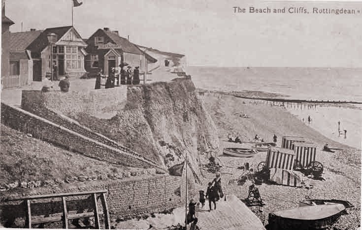
 The
cliffs Taken in 1913 this postcard shows a bulding soon to fall into
the sea. Notice in the far distance the Volk's Railway pier at Ovingdean Gap
The
cliffs Taken in 1913 this postcard shows a bulding soon to fall into
the sea. Notice in the far distance the Volk's Railway pier at Ovingdean Gap
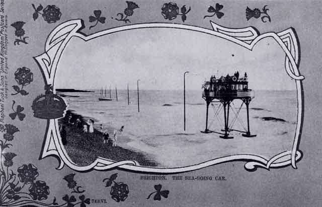
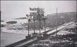
 The
pier at Rottingdean was built as the eastern end of Volk's Electric
Railway between 1894 and 1896. Between Black Rock and Rottingdean the sea thunders
against the chalk cliffs so Volk's solution was to build a sea going railway.
The Railway ran at the foot of the high cliffs and was 2.75 miles long. This
photograph was probably taken in early 1896 when the pier was still under construction.
The railway opened on 28th November 1896 to a great fanfare. Less than a week
later, on the night of the 4th and 5th of December a great storm destroyed Brighton's
old Chain Pier, badly damaged the original electric railway and all but destroyed
the project. Pioneer had broken from her moorings at Rottingdean and was exposed
to the full force of the storm. By morning she lay on her side broken almost
beyond repair. The damage was repaired and the railway reopened in July 1897
and continued until January 1901, despite frequent storm damage and shifting
shingle often covering portions of the track. The building of sea defences near
Black Rock in 1901 forced the closure of the sea going railway. No longer required
Pioneer was lashed to the pier at Ovingdean and remained in situ gently rusting
away until 1910 when the remnants of the railway were sold for scrap. The only
traces that remain of the railway are carved ruts in the chalk, a series of
concrete blocks and the stumps of wooden posts that become exposed at low tide.
The
pier at Rottingdean was built as the eastern end of Volk's Electric
Railway between 1894 and 1896. Between Black Rock and Rottingdean the sea thunders
against the chalk cliffs so Volk's solution was to build a sea going railway.
The Railway ran at the foot of the high cliffs and was 2.75 miles long. This
photograph was probably taken in early 1896 when the pier was still under construction.
The railway opened on 28th November 1896 to a great fanfare. Less than a week
later, on the night of the 4th and 5th of December a great storm destroyed Brighton's
old Chain Pier, badly damaged the original electric railway and all but destroyed
the project. Pioneer had broken from her moorings at Rottingdean and was exposed
to the full force of the storm. By morning she lay on her side broken almost
beyond repair. The damage was repaired and the railway reopened in July 1897
and continued until January 1901, despite frequent storm damage and shifting
shingle often covering portions of the track. The building of sea defences near
Black Rock in 1901 forced the closure of the sea going railway. No longer required
Pioneer was lashed to the pier at Ovingdean and remained in situ gently rusting
away until 1910 when the remnants of the railway were sold for scrap. The only
traces that remain of the railway are carved ruts in the chalk, a series of
concrete blocks and the stumps of wooden posts that become exposed at low tide.
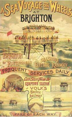 A
poster advertising the services of the railway: A ride on "Pioneer"
from Black Rock to Rotingdean was 6d ( two and a half new pennies)
A
poster advertising the services of the railway: A ride on "Pioneer"
from Black Rock to Rotingdean was 6d ( two and a half new pennies)
 A
picture of Pioneer running through the sea. : Notice the wooden
poles that carried the power cable.
A
picture of Pioneer running through the sea. : Notice the wooden
poles that carried the power cable.
 Another
view of the pier taken around 1896. The colourfully dressed ladies
in the foreground are standing on land soon to slip into the sea. Notice the
bathing tents and wheeled bathing cabins on the shore
Another
view of the pier taken around 1896. The colourfully dressed ladies
in the foreground are standing on land soon to slip into the sea. Notice the
bathing tents and wheeled bathing cabins on the shore
 Another
view of the pier taken around the same time as the previous picture
(1896). The tide has gone out further and you can see the rails.
Another
view of the pier taken around the same time as the previous picture
(1896). The tide has gone out further and you can see the rails.
 Another
view of the pier: Note the coastguard with telescope tucked under his
arm. In the distance you can just make out the pier at Ovingdean and "Pioneer"
docked there
Another
view of the pier: Note the coastguard with telescope tucked under his
arm. In the distance you can just make out the pier at Ovingdean and "Pioneer"
docked there
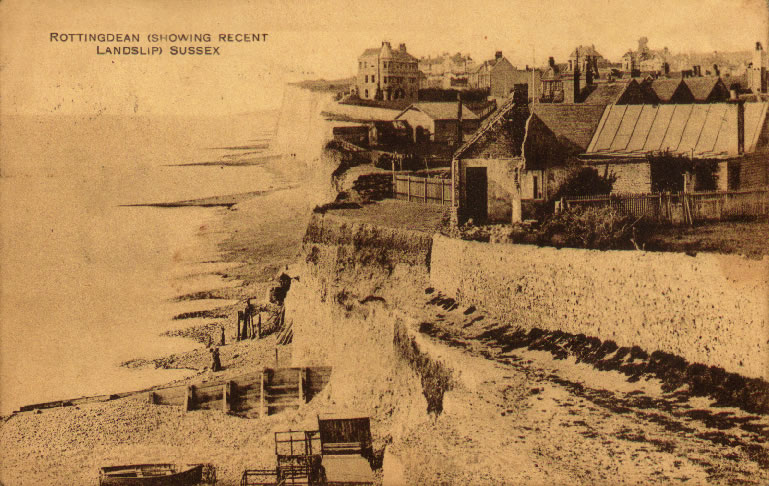 The
sea has now encroached further and this picture taken early 1900 shows
just how much has been swept away. Some of the builings in the earlier print
are now balanced precariously on the cliff edge.
The
sea has now encroached further and this picture taken early 1900 shows
just how much has been swept away. Some of the builings in the earlier print
are now balanced precariously on the cliff edge.
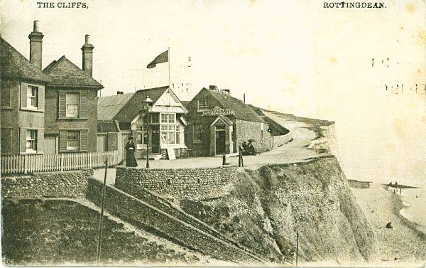 Now
partially fallen into the sea and the rest of the site replaced by Highview-
a block of flats on the sea front-what you can see here is the Geisha Tea Rooms
and Restaurant. Taken c 1919.
Now
partially fallen into the sea and the rest of the site replaced by Highview-
a block of flats on the sea front-what you can see here is the Geisha Tea Rooms
and Restaurant. Taken c 1919.
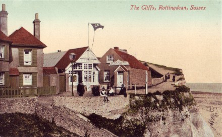 A
similar picture: Probably taken a year later because you can see guard
rails behin the people sitting on the wall. The Geisha Tea Rooms are flying a
flag marked "Geisha".
A
similar picture: Probably taken a year later because you can see guard
rails behin the people sitting on the wall. The Geisha Tea Rooms are flying a
flag marked "Geisha".
 A
rough seas: Probably taken in the 1920's
A
rough seas: Probably taken in the 1920's
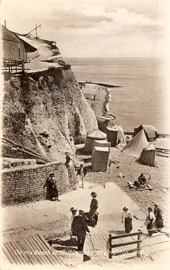
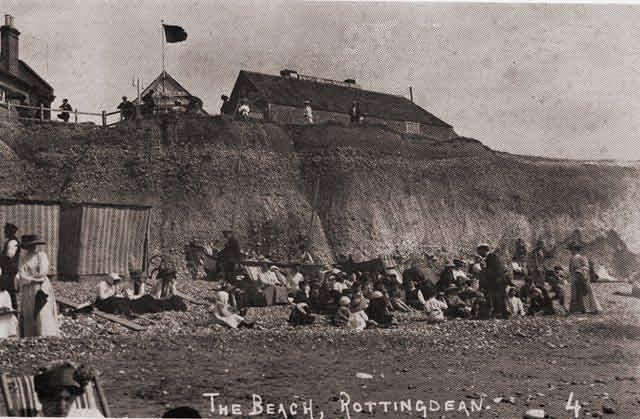
 The
beach at the gap:
The
beach at the gap:
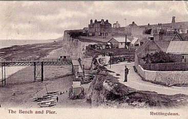
 Another
view of the pier c 1911
Another
view of the pier c 1911
 A
fairly similar view: Taken c 1935. More building has now taken place
A
fairly similar view: Taken c 1935. More building has now taken place
 Another
view of the pier c 1914
Another
view of the pier c 1914
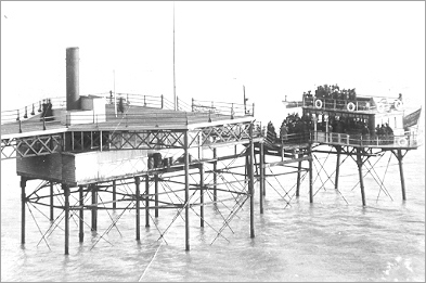
 Pioneer,
otherwise known as Daddy Longlegs, in action: Note the power transmission
cables stuck up on poles and the attachment from the vehicle.
Pioneer,
otherwise known as Daddy Longlegs, in action: Note the power transmission
cables stuck up on poles and the attachment from the vehicle.
 A
close up look at "Pioneer"- the railway carriage.
A
close up look at "Pioneer"- the railway carriage.
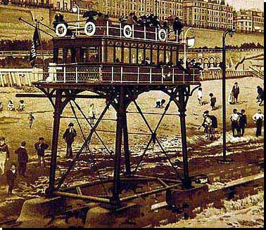
 Rottingdean
Pier head: . "Pioneer" has just docked at the pier head and
passengers are getting on. The electrical power unit is slung underneath the
pier. The pier head was a favourite place for Rudyard Kipling and children who
used to fish at the end of the pier. .
Rottingdean
Pier head: . "Pioneer" has just docked at the pier head and
passengers are getting on. The electrical power unit is slung underneath the
pier. The pier head was a favourite place for Rudyard Kipling and children who
used to fish at the end of the pier. .
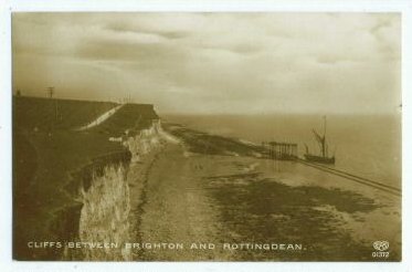
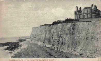
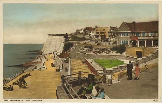
 The
Seafront- At Rottingdean Gap
The
Seafront- At Rottingdean Gap
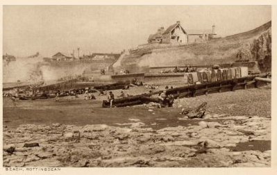
 The
beach by the Gap- Taken about the same time as the picture above.
The
beach by the Gap- Taken about the same time as the picture above.
 The
beach by the Gap- Taken about the same time as the picture above.
The
beach by the Gap- Taken about the same time as the picture above.
 The
beach by the Gap- Not a bikini in sight!
The
beach by the Gap- Not a bikini in sight!
The
Seafront- Taken c 1908.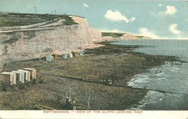
 The
beach and groins by the Gap- Taken sometime in the late 1920's. Note
the old houses tumbling into the sea
The
beach and groins by the Gap- Taken sometime in the late 1920's. Note
the old houses tumbling into the sea
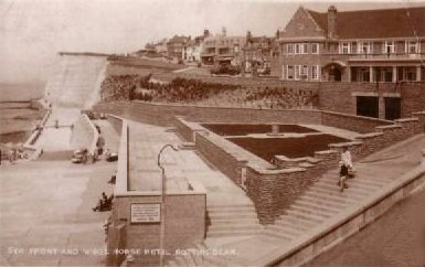
 The
Seafront again- Now turned into a concrete jungle. .
The
Seafront again- Now turned into a concrete jungle. .
 The
Seafront again- Taken in 1936 . .
The
Seafront again- Taken in 1936 . .
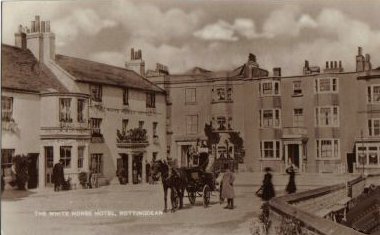
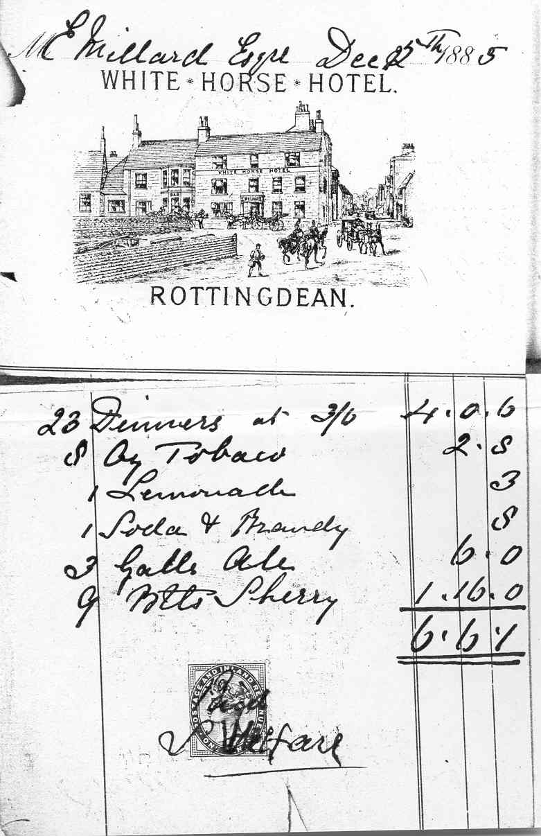
 The
White Horse Hotel
The
White Horse Hotel
 The
White Horse Hotel - taken around 1952.
The
White Horse Hotel - taken around 1952.
 The
White Horse Hotel
The
White Horse Hotel
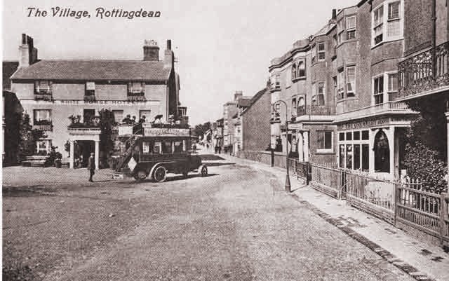
Now to go on a stroll through the village, starting from the Sea and walking
towards the north
 The
White Horse Hotel as it was c 1900- This was demolished in 1934 to
make way for the current building, also named the White Horse Hotel . An interesting
invoice from the White Horse Hotel for 1885 can
be found here
The
White Horse Hotel as it was c 1900- This was demolished in 1934 to
make way for the current building, also named the White Horse Hotel . An interesting
invoice from the White Horse Hotel for 1885 can
be found here
 White
Horse Hotel - Photograph taken around 1920 .
White
Horse Hotel - Photograph taken around 1920 .
 White
Horse Hotel - Photograph taken around 1920
White
Horse Hotel - Photograph taken around 1920
 White
Horse Hotel - Photograph taken around 1910
White
Horse Hotel - Photograph taken around 1910
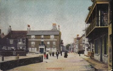
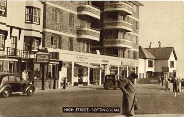
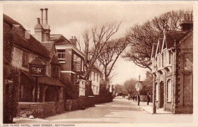
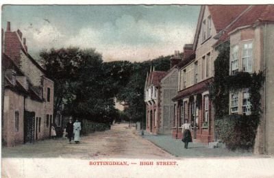
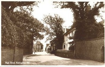
 High
Street - At the crossing with the coast road
High
Street - At the crossing with the coast road
 St.
Margarets- Photograph taken around 1950 . The flats were built in the
late 1930's despite a lot of local opposition to them at the time. The Local
Ratepayers Association when voicing their opposition to them said that "it
views this monstrous structure with horror and dismay; feelings shared by practically
every inhabitant of Rottingdean" . Views probably still shared to this
day.
St.
Margarets- Photograph taken around 1950 . The flats were built in the
late 1930's despite a lot of local opposition to them at the time. The Local
Ratepayers Association when voicing their opposition to them said that "it
views this monstrous structure with horror and dismay; feelings shared by practically
every inhabitant of Rottingdean" . Views probably still shared to this
day.
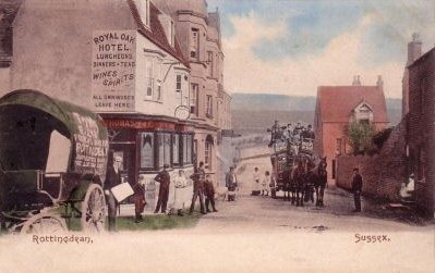 Royal
Oak Hotel- The horse drawn carriage is on the coast road and stands
by the junction with the High Street. Virtually everything has been demolished
now. The Royal Oak, and the former Victoria Inn behind, for example, used to
be where the West Street car park is today.
Royal
Oak Hotel- The horse drawn carriage is on the coast road and stands
by the junction with the High Street. Virtually everything has been demolished
now. The Royal Oak, and the former Victoria Inn behind, for example, used to
be where the West Street car park is today.
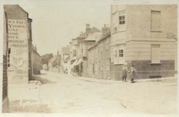
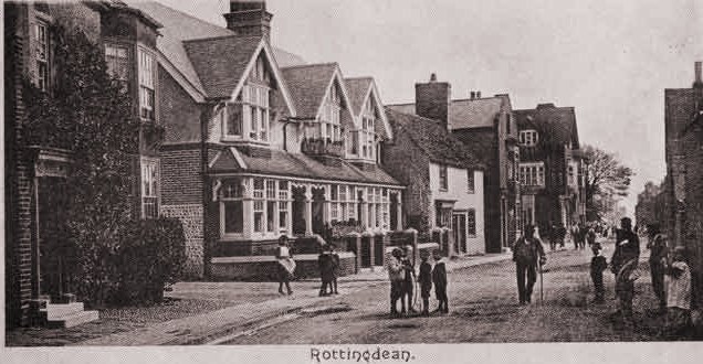
Rottingdean High
Street - 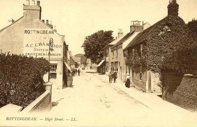
 The
High Street- Looking north.
The
High Street- Looking north.
The High Street- Looking
north.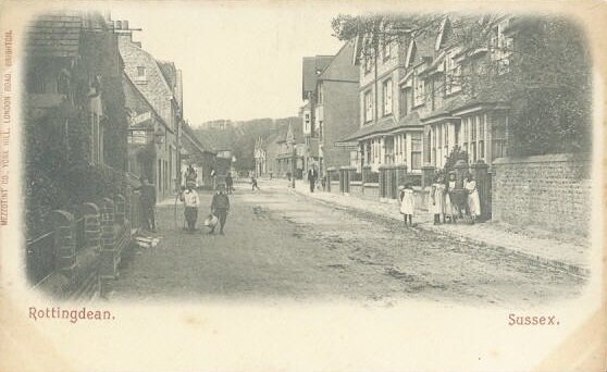
 The
High Street- Looking north.
The
High Street- Looking north.
The High Street- Another
picture looking north- around 1910.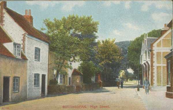
 The
High Street- Another picture looking north- around 1910.
The
High Street- Another picture looking north- around 1910.
 The
High Street- Looking north c 1906.
The
High Street- Looking north c 1906.
 The
High Street- Looking north, a little further up the village.
The
High Street- Looking north, a little further up the village.
 The
High Street- Looking south.
The
High Street- Looking south.
 The
High Street- Looking south.
The
High Street- Looking south.
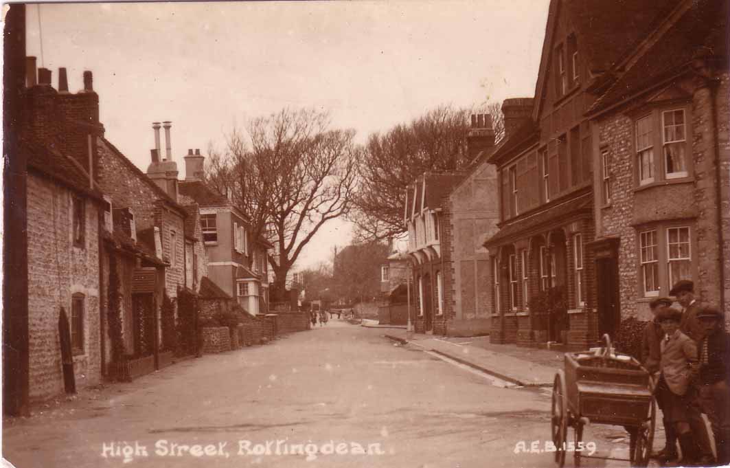
 The
High Street- The wall of Rudyard Kipling's House is to be seen towards
the left of the picture..
The
High Street- The wall of Rudyard Kipling's House is to be seen towards
the left of the picture..
The same scene around 1925 -
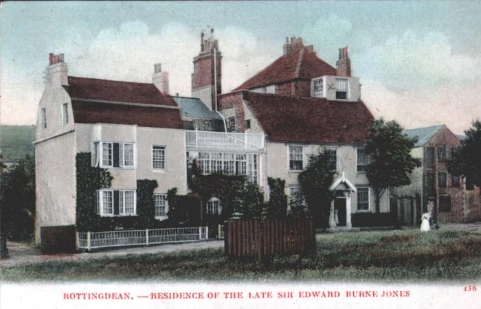
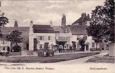 Burne
Jones's House- Seen from the village green across from the Church of
St Margaret's.. When Burne Jones moved to Rottingdean in 1880 he merged three
adjacent houses together: Gothic House, Prospect House and Aubrey Cottage to
create 'North End House' - the house that you see in the picture. Prospect House
is the White House on the left of the three. Aubrey Cottage the middle building
and Gothic House is to the right
Burne
Jones's House- Seen from the village green across from the Church of
St Margaret's.. When Burne Jones moved to Rottingdean in 1880 he merged three
adjacent houses together: Gothic House, Prospect House and Aubrey Cottage to
create 'North End House' - the house that you see in the picture. Prospect House
is the White House on the left of the three. Aubrey Cottage the middle building
and Gothic House is to the right
 Another
view of Burne Jones's house- probably taken around the same time
Another
view of Burne Jones's house- probably taken around the same time
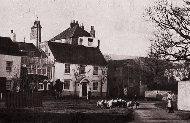 Another
view of Burne Jones's house- The scene of sheep and shepherd was soon
to disappear.
Another
view of Burne Jones's house- The scene of sheep and shepherd was soon
to disappear.
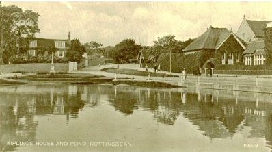
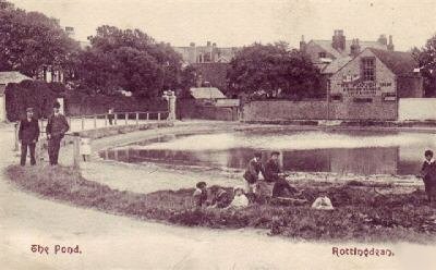 The
Pond- Taken in 1905 the picture shows the pond and the Plough Inn in
the background. Very little has changed since then..
The
Pond- Taken in 1905 the picture shows the pond and the Plough Inn in
the background. Very little has changed since then..
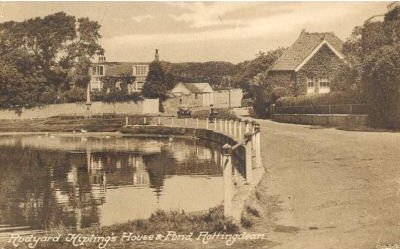 The same pond- taken in the 1950's,
viewed from the south and looking upon The Elms.
The same pond- taken in the 1950's,
viewed from the south and looking upon The Elms.
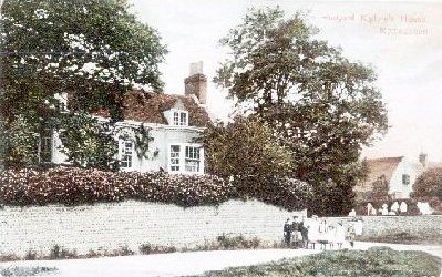
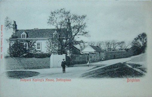 The
Elms- 1910 Rudyard Kipling's House
The
Elms- 1910 Rudyard Kipling's House
 The
Elms- 1910 Rudyard Kipling's House
The
Elms- 1910 Rudyard Kipling's House
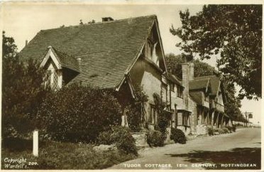 Tudor
Cottages at the entrance to Dean Court Road- Originally farm buildings
and cottages associated with Court Farm these were converted into mock
Tudor style cottages in the early 1930's
Tudor
Cottages at the entrance to Dean Court Road- Originally farm buildings
and cottages associated with Court Farm these were converted into mock
Tudor style cottages in the early 1930's
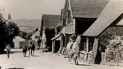 Tudor
Cottages again- Note the windmil in the far distance without the usual
sail arms.
Tudor
Cottages again- Note the windmil in the far distance without the usual
sail arms.
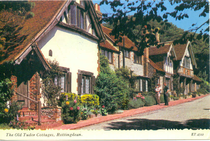 Tudor
Cottages- An idyllic picture, with buildings somewhat different from
their original function
Tudor
Cottages- An idyllic picture, with buildings somewhat different from
their original function
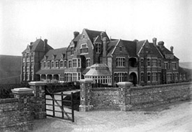
 Tudor
Close Hotel- These apparently looking Tudor buildings were originally
two old barns and the cowsheds of old Court Farm. They were some 100
feet in length and were substantially rebuilt in 1929 to look like seven adjoining
dwellings of the Tudor period. They proved difficult to sell 1929 and the houses
were quickly remodeled to form the Tudor Close Hotel that you see here. The
hotel proved to be a fashionable halt for visitors to Rottingdean in the 1930's.
After the second world war the Hotel lost much of its custom and the building
was altered yet again to form the seven adjoining houses that now occupies the
site..
Tudor
Close Hotel- These apparently looking Tudor buildings were originally
two old barns and the cowsheds of old Court Farm. They were some 100
feet in length and were substantially rebuilt in 1929 to look like seven adjoining
dwellings of the Tudor period. They proved difficult to sell 1929 and the houses
were quickly remodeled to form the Tudor Close Hotel that you see here. The
hotel proved to be a fashionable halt for visitors to Rottingdean in the 1930's.
After the second world war the Hotel lost much of its custom and the building
was altered yet again to form the seven adjoining houses that now occupies the
site..
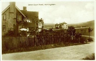 Dene
Court Road- Taken c 1925 .
Dene
Court Road- Taken c 1925 .
 Rottingdean
School - The School is situated to the north of the village and was
built in 1894. When this picture was taken in 1896 the School had only recently
opened. It was to remain until 1962 when it was demolished after a major fire.
Shortly afterwards the site was cleared to make way for a Trade Union rest centre
and some domestic housing(The Rotyngs) . Even the Trade Union centre has been
demolished now and all that remains are tightly packed housing at the end of
the village.
Rottingdean
School - The School is situated to the north of the village and was
built in 1894. When this picture was taken in 1896 the School had only recently
opened. It was to remain until 1962 when it was demolished after a major fire.
Shortly afterwards the site was cleared to make way for a Trade Union rest centre
and some domestic housing(The Rotyngs) . Even the Trade Union centre has been
demolished now and all that remains are tightly packed housing at the end of
the village.
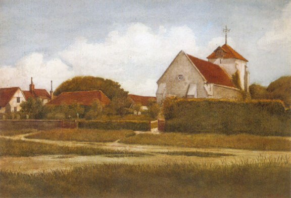 St
Margaret's Church - .
St
Margaret's Church - .
 St
Margaret's Church -
St
Margaret's Church -
 St
Margaret's Church - .
St
Margaret's Church - .
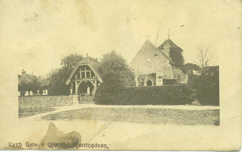
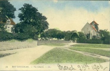
 The
Lychgate of St Margaret's Church- The Lych Gate was built in 1897 to
serve as the grand entrance to St Margaret's Churchyard. This postcard dates
from 1905 and on the right you can see Rudyard Kipling's old house, The Elms,
whilst to the left is Burne Jones's property, The Elms. On the downs beyond
is the old windmill .
The
Lychgate of St Margaret's Church- The Lych Gate was built in 1897 to
serve as the grand entrance to St Margaret's Churchyard. This postcard dates
from 1905 and on the right you can see Rudyard Kipling's old house, The Elms,
whilst to the left is Burne Jones's property, The Elms. On the downs beyond
is the old windmill .
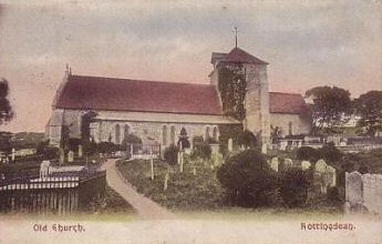 St
Margaret's Church- Taken from the South c 1906
St
Margaret's Church- Taken from the South c 1906
 The
Elms- Rudyard Kipling's House is to be seen across the pond from this
vantage point. More about this house later.
The
Elms- Rudyard Kipling's House is to be seen across the pond from this
vantage point. More about this house later.
 The
Elms- Rudyard Kipling's House.
The
Elms- Rudyard Kipling's House.
 A
composite picture of Rottingdean- Looking Westwards.
A
composite picture of Rottingdean- Looking Westwards.
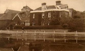 Norton
House and the Pond-
Norton
House and the Pond-
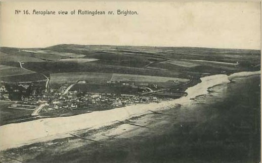
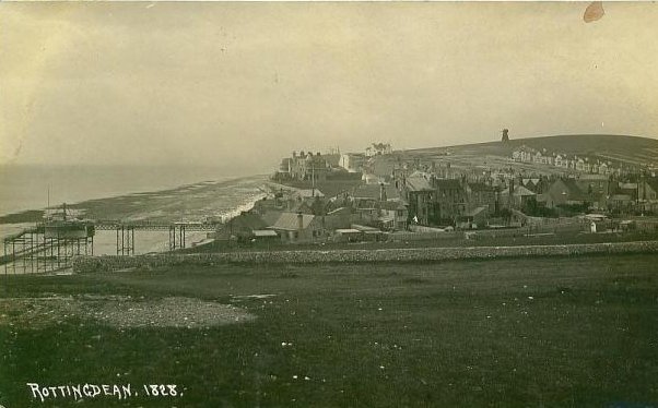
Rottingdean in 1920: No undercliff walk. No
Saltdean!
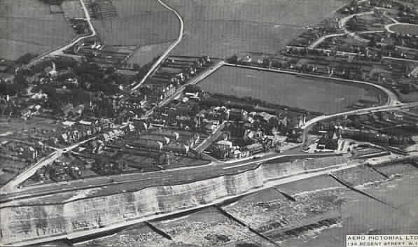
Rottingdean in 1932
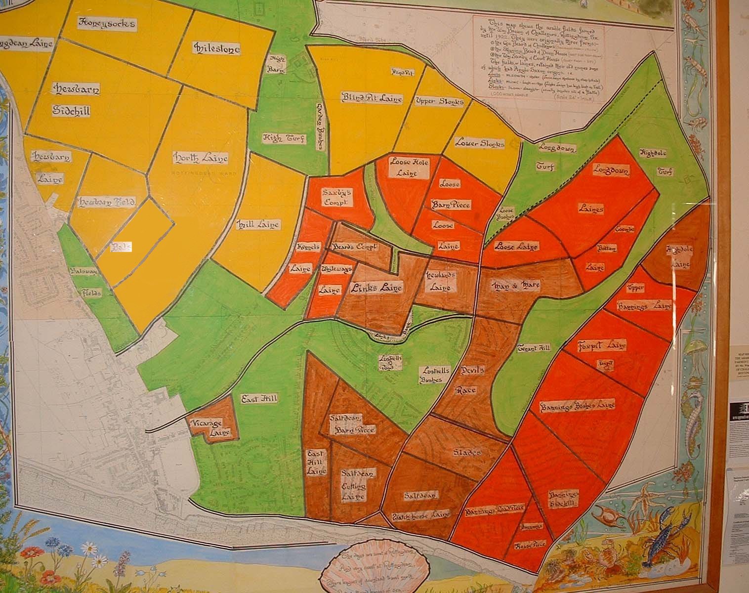
A map showing the old field system for East Rottingdean
and Saltdean is displayed below which you can compare with the 1920's photo.
Click on the map to expand the image.
A map dating 1879-1880 is shown below. Click
on the map to expand image
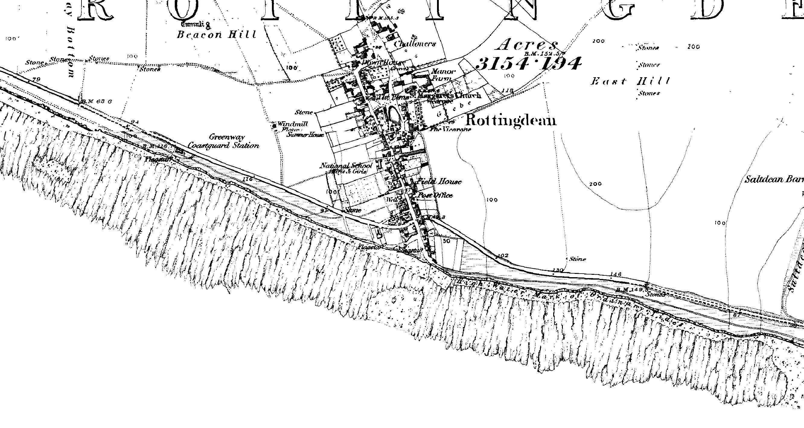
Image produced from the www.old-maps.co.uk
service with permission of Landmark
Information Group Ltd. and Ordnance
Survey
1899 Map of Rottingdean- Click
on the map to expand image. The Electric Railway has now been built.

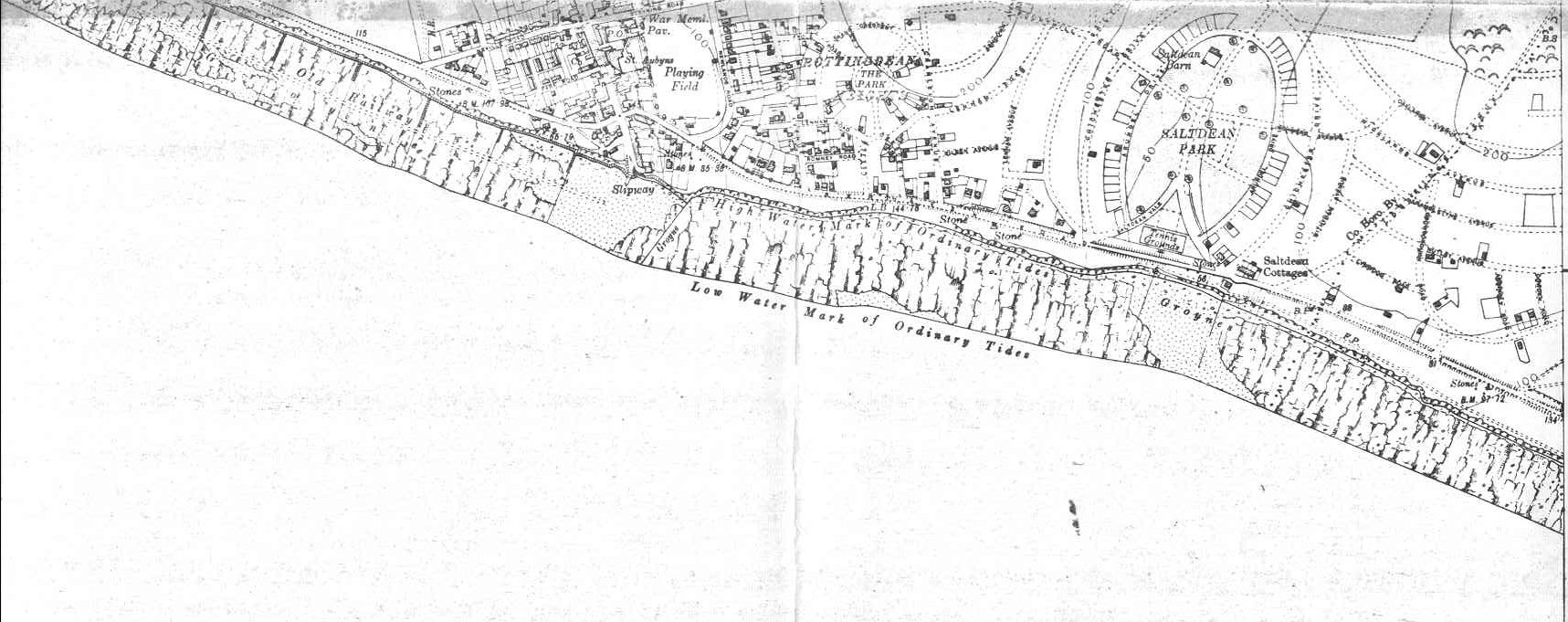
1931 Map of Rottingdean- Click
on map to expand. Notice that the roads of Saltdean have been laid out and houses
are beginning to appear.
Two very good books that can be recommended for postcards of the
earlier days are:
Rottingdean in Old Picture Postcards by A.S. Payne, Eddie Scott
; Publisher: Europese Bibliotheek B.V., Uitgeverij Boekhandel A ; ISBN: 9028833102
Francis Frith's Around Brighton and Hove (Photographic Memories.)
by Helen Livingston, Francis Frith ; Publisher: The Frith Book Company Ltd ;
ISBN: 1859371922
